Maximising thermal comfort for all
building types


Why choose us?
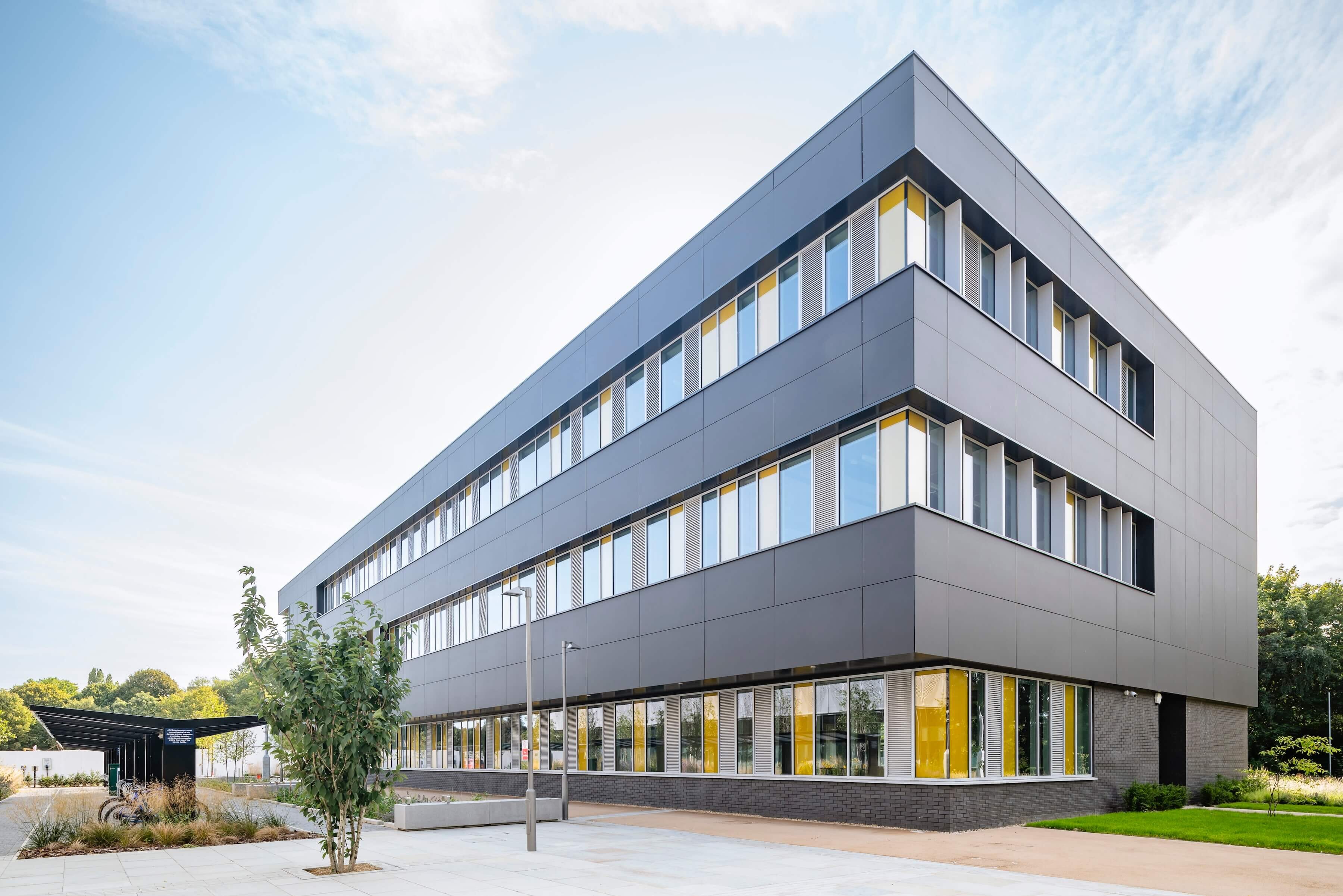
Encon Associates offers Thermal Modelling services for all building types, enabling developers to achieve regulatory compliance and enhance thermal comfort for occupants.
Understanding Thermal Modelling
What is Thermal Modelling?
By assessing factors such as thermal loads, ventilation, and potential overheating risks, Thermal Modelling provides key insights into how a building will perform under various weather conditions and occupancy scenarios.
Thermal Modelling is essential for compliance with Part O of the UK building regulations, as well as the CIBSE guidelines for TM52 and TM59. Integrating Thermal Modelling during the early design stages can help you address any challenges early, such as overheating risks or inadequate ventilation, and implement various retrofitting measures that significantly enhance occupant comfort. If you’re working towards BREEAM certification, Thermal Modelling can also aid you in achieving vital credits for Hea 04.

Our Thermal Modelling service
The Encon Associates approach to Thermal Modelling
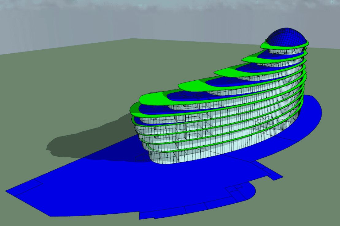
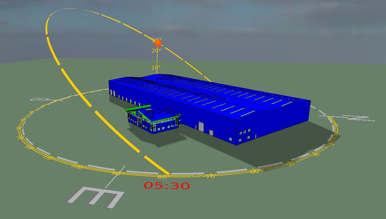
As a working partner of the world’s leading software provider IES (Integrated Environmental Solutions), we utilise the AM11 compliant software suite IESVE to provide the most accurate thermal simulations available. This allows us to accurately pinpoint areas within your building that are susceptible to overheating risks or poor ventilation, enabling you to address any issues before construction begins.
At Encon Associates, we understand that every project is unique. That’s why we work closely with clients to provide tailored, easy-to-understand Thermal Modelling reports that include visual evidence and practical advice for improving a building’s thermal performance. Whether it be optimising plant sizing for thermal loads or mitigating overheating risks, we can help you meet your energy and thermal performance targets with confidence.

We partner with organisations like yours


I arranged a thermal survey as we have an extended house with significant colder areas. The survey was quickly organised and comprehensive. Everyone involved was friendly and easy to talk to. The results in the report were also explained/interpreted to me in detail, which greatly assists with the understanding of where /why heat loss was occurring.
As a result of the survey, I have found a number of places where insulation is lacking or even non existent and I am in the process of correcting this.
I would recommend the service.
Additional services
We offer a wide array of specialist services that complement our Thermal Modelling services and are designed to boost your project’s overall sustainability rating.
From Daylight Calculations and Tree Surveys to Traffic Assessments and Acoustic Reports, our team provides the technical expertise you need to achieve the highest energy assessment rating possible.


Want to gain environmental credits or need planning advice for your next project?
Call: 0115 987 55 99 or email:
Frequently asked questions about Thermal Modelling
Call: 01159 875 599 or email: